Stop Me If I Drone On
July 20, 2020 10:49 am 1 Comment
For my second entry in the Green Dream Blogs, I would like to share my experiences flying drones with you!
Through the excitement of moving to Grande Prairie and starting work, the first couple of weeks were like many other jobs. Getting to know your supervisors, understanding the operating procedures of accessing your physical workspace (very important during a global pandemic) and general safety training were all things that we participated in while settling into our respective roles. Engaging in training sessions for the first few days can be pretty tedious, considering all training took place remotely from our homes. Though most of the training was informative and worthwhile, there was one training session that piqued my interest more than the others, and for obvious reasons. I was instructed to spend a day reading through the knowledge requirements for Pilots of Remotely Piloted Aircraft Systems (RPAS) and the operation of drones with Visual Life-of-Sight (VLOS).
I was going to fly drones this summer! I was excited to participate in a trend that is sweeping through a variety of businesses and to gain experience in a piece of technology that is likely to take over our industry as a valuable recon and imagery collection tool. When my manager sent me the study guide for RPAS, my excitement faded slightly: “General knowledge of the following topics is needed to successfully pass the basic pilots exam.” The list of topics was as follows:
Section 1: Air law, air traffic rules and procedures
Section 2: RPAS airframes, power plants, propulsion and systems
Section 3: Human factors
Section 4: Meteorology
Section 5: Navigation
Section 6: Flight operations
Section 7: Theory of flight
Section 8: Radiotelephony
Luckily, my brain was still in “exam mode” from having just completed 3rd year finals in university. Studying the material was tough, but I figured if I could get through the information once or twice, I should be able to complete the test with a passing grade of 65% or higher. The reality was that there was too much information to read in one day and eventually, I opted to scan through the remaining material quickly and take a shot at the $10 exam. With a combination of lucky questions (they randomly generate for each exam, meaning they can be easy, difficult or a combination), passable knowledge in the material and the comfort of knowing the exam could be taken again for the same low price, I was successful.
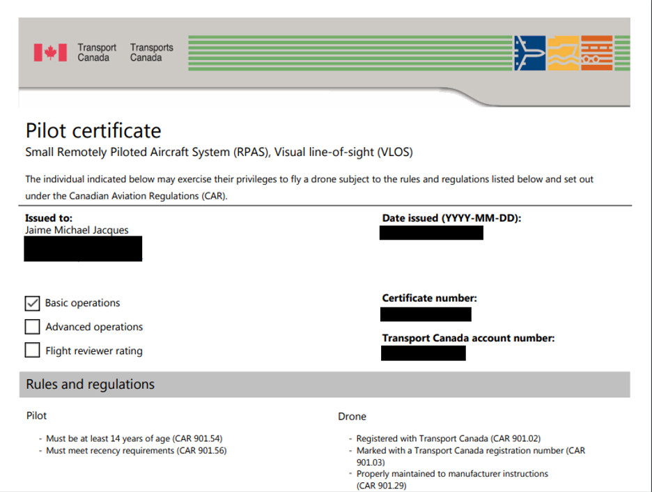
Drone certification redacted for privacy.
On my first day with my drone, one of my managers accompanied me to a cut block that needed to be flown. He showed me the basic controls and how Drone Deploy works.
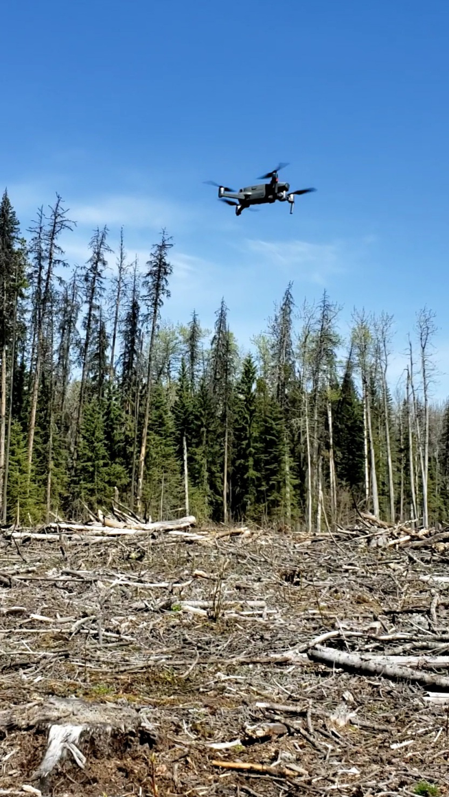
Drone taking off from a nearby stump.
Drone Deploy is a drone data software collection app that helps users collect, manage, and interpret the data they collect on their drones. The app allows the user to create flight paths on the spot or plan several flights into large project folders from a computer. The imagery can be uploaded to the app via a “live map” feature, meaning the imagery taken is directly fed to the app via your internet connection, or the imagery may be uploaded later through USB. Once uploaded, the imagery can be interpreted in different ways. The user can scan the imagery captured over cut blocks to check that roads were properly reclaimed, slash piles were effectively disposed of and to see if any usable timber was left behind. It feels and operates very much like exploring using the Google Maps satellite feature.
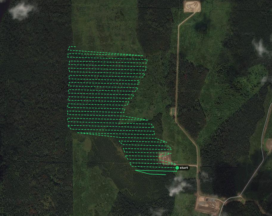
Drone Deploy preview of a block to be flown. The green lines are the intended flight path.
The first flight was going smoothly, until the drone lost its GPS connection to the app, meaning that it was no longer following the flight path set on Drone Deploy and was drifting away. We quickly placed the drone controller into “sport mode” which allows for manual flight. We returned the drone safely, but unfortunately, this was foreshadowing to my first few days of flying solo.
Drone Deploy preview of a successfully flown block.
Plagued by nearly constant GPS disconnections that required manual piloting to return the drone safely, I was given a different drone and my connection issues finally subsided. Technical issues did not go by the wayside however, and I struggled with the app not loading properly on my iPad for several days. I believe the issue was a service problem. The app did not seem to load any of the planned flight projects if I was without service on my mobile devices. Luckily, most of the management area that Weyerhaeuser Grande Prairie operates in has reliable cell coverage. That being said, many other drone users in the office seem to fly with Drone Deploy offline with no problems. To this point, I was required to connect my iPad to the mobile data on my cell phone via the hotspot feature. The installation of a proper SIM card into my iPad a few weeks later and a redownload of the app seem to have helped solve my issues for the time being.
With most of my technical issues resolved, or partly resolved, I was off to the races, flying several blocks a day. The app allows the user to track the drone on the map that is generated, or to view the images as they are being captured. It is very interesting to see blocks from this top-down perspective.
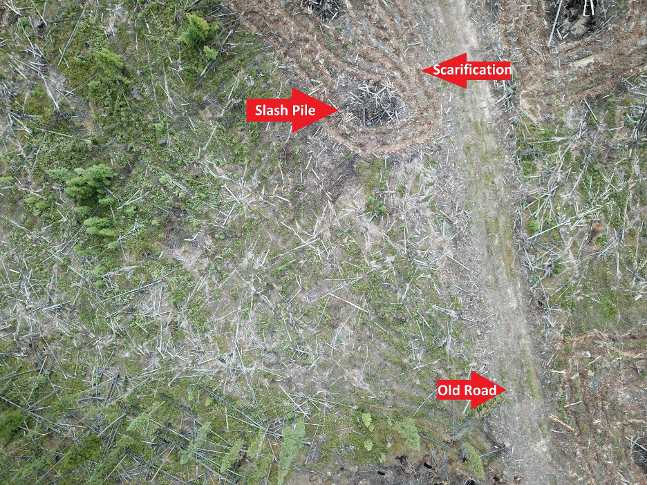
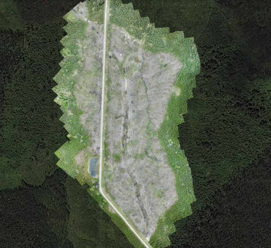
Imagery capture that displays residual slash throughout the block, a burnt slash pile, scarification to facilitate planting and the old block road.
The photos provided in this blog are low quality compared to what is truly extracted by the user on the computer, but it gives you a good idea of what a drone’s capabilities are. With the newer models of drones floating around the office, imagery feels as though it is sometimes crystal clear, even when the user is zoomed into the full extent possible.
The use of RPAS in our industry, with the technological blunders I encountered aside, have a tremendous potential to be a useful tool. The captured overhead imagery can help users inspect hard-to-reach areas by providing a glimpse into the layout of the landscape, measure volumes of lumber or chip piles via the 3D capabilities found in the app, mapping harvest areas and providing a visual interpretation of valuable post-harvest assessments. Thinking a little more about the use of a drone shows almost limitless application to these units. Stream inspections, disease monitoring, designing digital elevation models and monitoring harvest operations can all be achieved with the use of a drone. The units are affordable and easy to use once the user has the required certifications. I look forward to flying more blocks this summer, and I am confident that the experience I gain flying for Weyerhaeuser will be an asset in future employment opportunities.
1 Comment
I laughed way too long at the title, great blog!! Think we do have the same drone! Good job not crashing